John Rayner
The Ohio State University
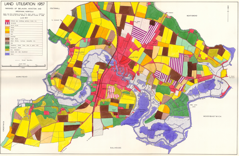
All characters drawn individually with a stencil (photo link), many lines drawn freehand and colors painted with a brush. One of nine 3ft x 2ft maps submitted with a dissertation for BA (Hons) at the U. Birmingham, UK in 1958.
Garima Mandavya
University of Cincinnati
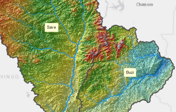
This is a map of Save and Buzi hydrologic basins. The basin boundaries were delineated using DEM on Arcmap. The overlay of DEM and Hill shade allows a 3D view of the map.
Ningli Xu
The Ohio State University
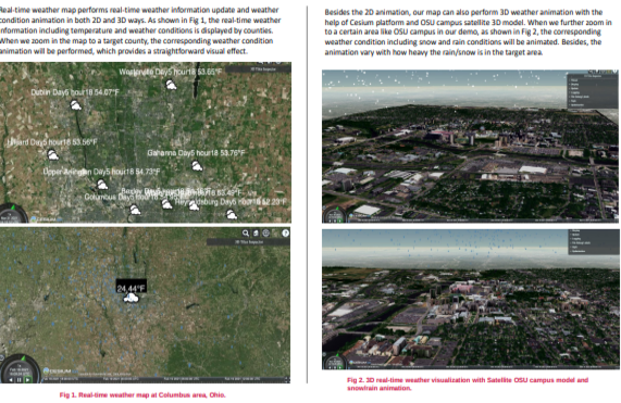
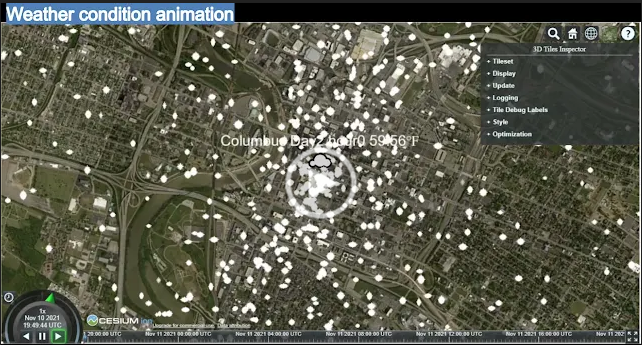
This project is aimed at providing a realistic weather condition animation based on satellite 3D model with real-time weather information updates and weather condition animations in both 2D and 3D ways.
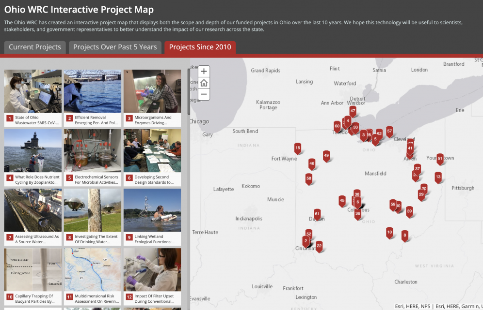
Qing Wan
The Ohio State University
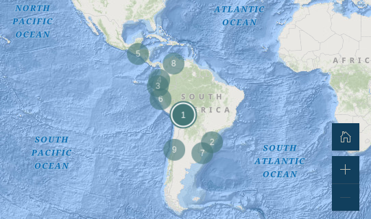
This map displays the scope and depth of the funded projects of the Ohio Water Resources Center (WRC), for scientists, stakeholders, and government representatives to better understand the impact of their research.
Patricia Neel Dittoe
The Ohio State University
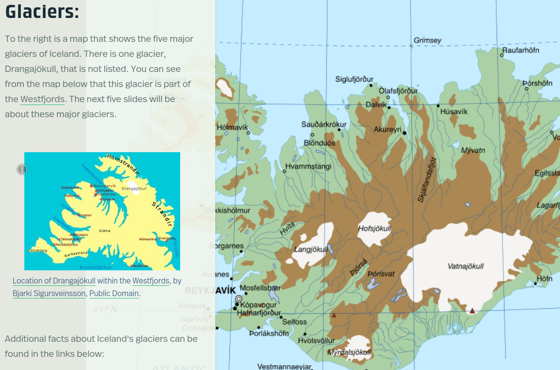
An island of Glaciers, Volcanoes, and Unique Geology.
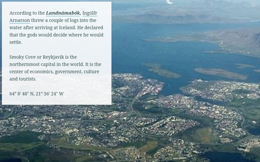
Jan Wagner
The Ohio State University
This story map is reminiscent of old postcards -- pretty pictures with short descriptions that may lead the reader to discover more. We chose Iceland as a topic for the dramatic geologic features and the growing tourist industry.
Leopold Tong
The Ohio State University
This is a 39-second animation visualizing the spread of COVID-19 between Ohio counties from Feb 2020 to Oct 2021. Each keyframe shows the 1st day of each month. Note: The animation does take a couple seconds to load.
Alena Sorensen
Case Western Reserve University
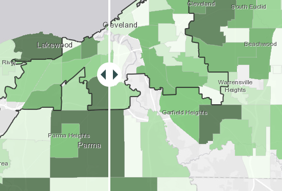
This StoryMap explores the impact of COVID-19 on the child care delivery system in Cuyahoga County and provides local stakeholders with information intended to help them respond effectively and equitably to the pandemic.
Pranav Padmanabhan
The Ohio State University
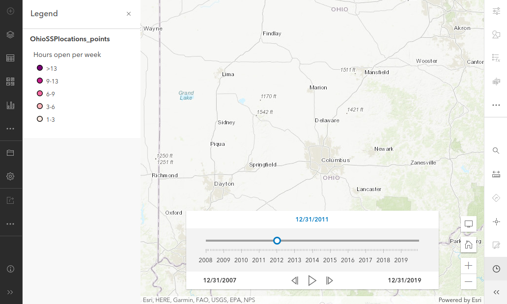
This map shows the locations of all open Syringe Service Programs (SSPs) in Ohio from 2008-2020. SSPs are an important public health intervention to reduce rates of HIV, Hepatitis C, and drug overdoses by providing supplies and a safe community.
Devin Suttles
The Ohio State University
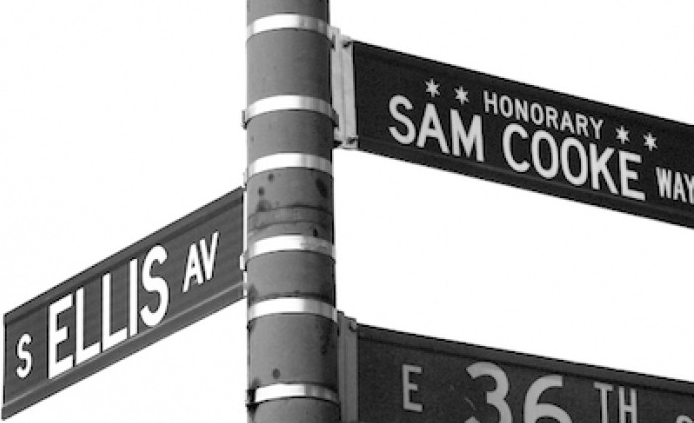
This interactive map captures the artistry of Sam Cooke that is produced by the everlasting Black struggle while preserving the beauty of his legacy as became one of the pioneers of the Civil Rights movement.
Courtney Fleming
The Ohio State University
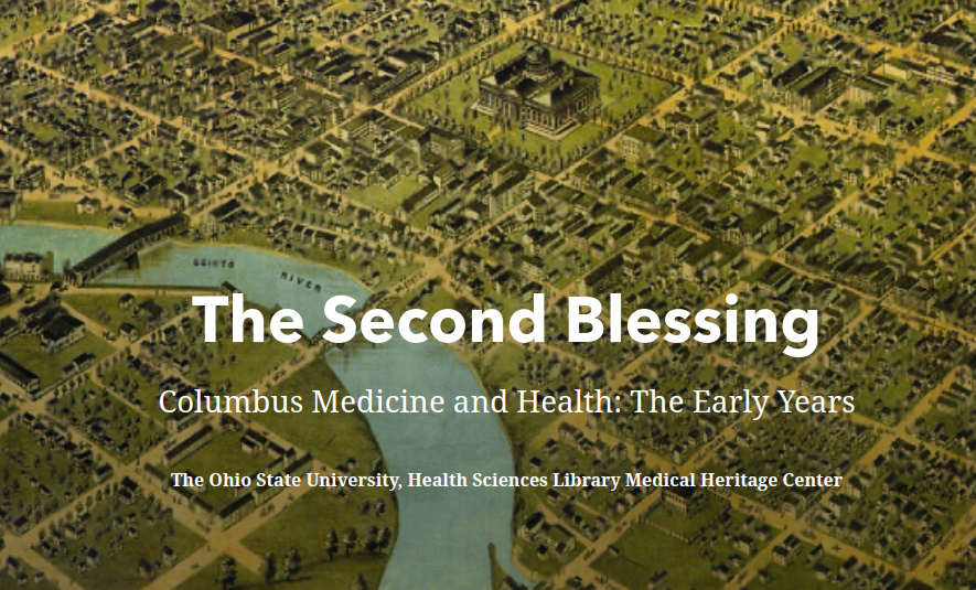
We transform "The Second Blessing: Columbus Medicine and Health--The Early Years," a book written by Charles F. Wooley and Barbara A. Van Brimmer, into an interactive, visual digital experience.
Gabriel Zeballos Castellon
The Ohio State University
This story map is a window to cultural richness and diversity in Latin America countries and intends to motivate curiosity of people about the festivities around the celebration of the gone beloved friends and relatives.
Ningli Xu
The Ohio State University
Real-time weather map performs real-time weather information update and weather condition animation in both 2D and 3D ways. This is the video material for this work.
Tara Allen
The Ohio State University
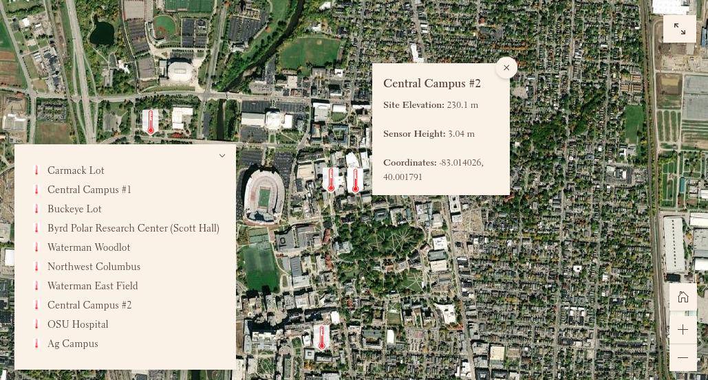
My map illustrates the locations of the urban heat island stations that have been set up on and around Ohio State's campus, to better inform people about the project. These stations track temperature, relative humidity, vapor pressure, and other factors.
John Brett
The Ohio State University
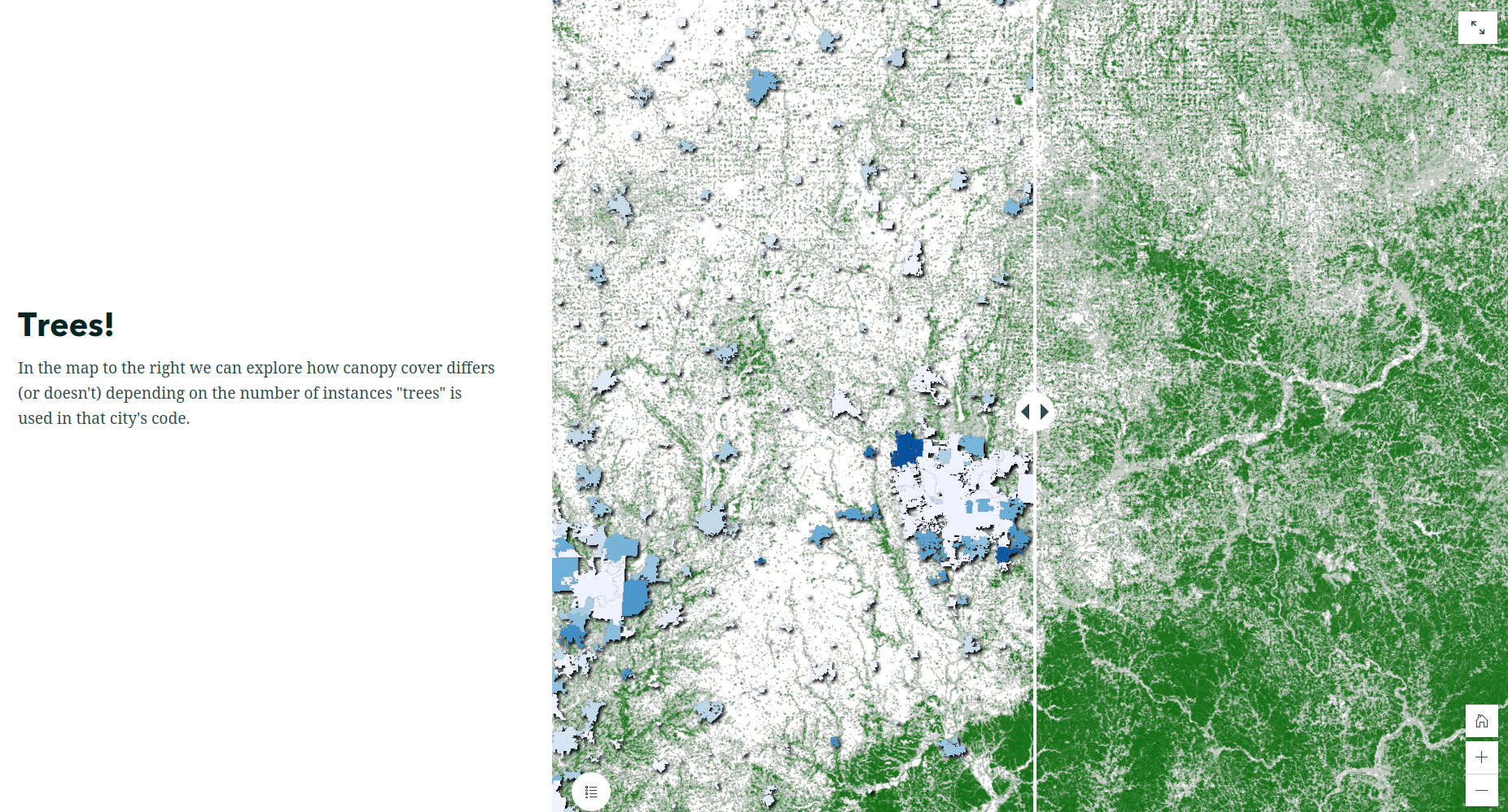
This map represents a tool I developed to do a word frequency analysis across Ohio municipal codes, tying the results to the incorporated areas they have jurisdiction in. I include a wide range of words so researchers might see how it could tie to their own work.